FAA Part 107 Remote Pilot Knowledge Test (UAG) · 2026 Edition
Part 107 Study Guide — 2026 Edition
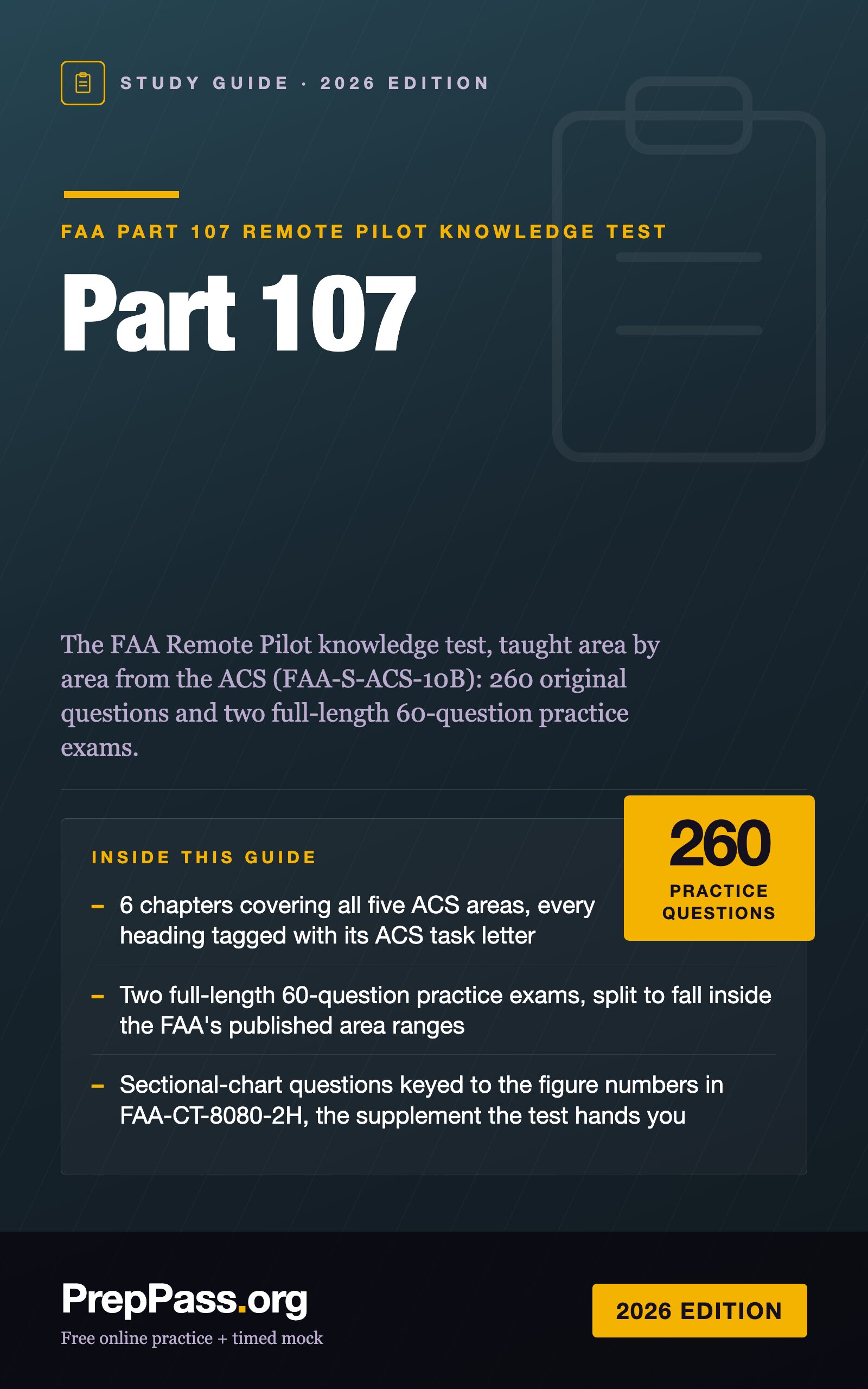
The FAA Remote Pilot knowledge test, taught area by area from the ACS (FAA-S-ACS-10B): 260 original questions and two full-length 60-question practice exams.
- 260 original FAA Remote Pilot practice questions, each with a worked explanation, in one PDF + EPUB you keep
PDF + EPUB · English · 205 pages · $19.99 one-time
This book is written in English.
Instant download after payment — no account needed, no subscription.
14-day money-back guarantee: not satisfied for any reason? Email support@preppass.org within 14 days of purchase for a full refund. Refund policy
Try 10 questions first — free
Answer all 10, then see every answer explained — with the section of this guide that teaches it. About 5 minutes, no sign-up.
Start 10 free questionsLook inside the book
Three real pages, rendered straight from the PDF you download — a reference page, a teaching page, and a worked question, always in that order. Nothing here was redrawn to look better.
- Quick referenceChapter 3 — Weather (ACS Area III) · PDF page 79
A page you can turn back to: the numbers, deadlines or terms gathered in one place.
- How it's taughtAnswer key & explanations · PDF page 168
An explanation page: the material taught in prose, in the order the exam tests it.
- A question, workedChapter 2 — Airspace Classification and Operating Requirements (ACS Area II) · PDF page 58
A practice question with its answer and the reasoning behind it — not just a key.
Questions buyers ask
- Is a study guide enough for the FAA Part 107 Remote Pilot Knowledge Test (UAG) exam, or do I need a course?
- A book is exam review: it does not replace any education, training or experience your licensing body requires before you may sit the exam, so check those requirements first. For the exam content itself, this 205-page guide teaches the material chapter by chapter with 260 practice questions and explanations inside, and 100 more practice questions are free on PrepPass. A prep course adds live instruction and a set schedule; whether you need one beyond any required education is your call.
- What is the cheapest way to prepare for the FAA Part 107 Remote Pilot Knowledge Test (UAG) exam?
- Start with what costs nothing: 100 practice questions on PrepPass, with explanations and no signup. If you want it taught in one file you keep, the full study guide is $19.99 once. No subscription on any of them.
- Does the FAA Part 107 Remote Pilot Knowledge Test (UAG) study guide come as a PDF?
- Yes — Part 107 Study Guide — 2026 Edition downloads as PDF and EPUB, 205 pages. The download link is emailed the moment payment clears and does not expire.
- How much does the FAA Part 107 Remote Pilot Knowledge Test (UAG) study guide cost?
- $19.99, once. There is no subscription and no account to create; the PDF and EPUB files are yours to keep.
- Are there free FAA Part 107 Remote Pilot Knowledge Test (UAG) practice questions?
- Yes — 100 of them, free to use with no signup and an explanation on every one. They are separate from this study guide, which is what you are buying here.
- Can I read part of the FAA Part 107 Remote Pilot Knowledge Test (UAG) study guide before buying?
- Yes. A full chapter is free to read on this page — not a summary of one, the chapter itself.
- Is this the official FAA Part 107 Remote Pilot Knowledge Test (UAG) study guide?
- No. This is an independent study guide and is not affiliated with or endorsed by the exam's awarding body. It is written from FAA Remote Pilot ACS (FAA-S-ACS-10B, effective April 6, 2021), 14 CFR part 107 (eCFR, September 2026), AC 107-2A and FAA-CT-8080-2H. Always confirm current requirements with the body that issues your licence.
Free FAA Part 107 Remote Pilot Knowledge Test (UAG) practice questions and study chapters →
What's included — and what isn't
Included
- 6 chapters covering all five ACS areas, every heading tagged with its ACS task letter
- Two full-length 60-question practice exams, split to fall inside the FAA's published area ranges
- Sectional-chart questions keyed to the figure numbers in FAA-CT-8080-2H, the supplement the test hands you
- Five worked job plans that walk a real flight from phone call to debrief
- 260 original questions, each with a worked explanation citing its source
- PDF + EPUB you keep
Not included
- No printed copy is shipped — this is a file you download and can print yourself
- No video course, instructor or tutoring comes with the book — the free videos on the site are separate
- Not your exam registration or the testing centre's fee, which you still pay to the official body
Contents
See 9 sections and the page each one starts on
- Chapter 1 — Regulations (ACS Area I)p. 10
- Chapter 2 — Airspace Classification and Operating Requirements (ACS Area II)p. 41
- Chapter 3 — Weather (ACS Area III)p. 63
- Chapter 4 — Loading and Performance (ACS Area IV)p. 88
- Chapter 5 — Operations, Part 1: Radio, Airports and Emergencies (ACS Area V, Tasks A–C)p. 100
- Chapter 6 — Operations, Part 2: Decision-Making, Physiology and Maintenance (ACS Area V, Tasks D–F)p. 122
- Answer key & explanationsp. 142
- Appendix A — The exam at a glance, in one tablep. 195
- Appendix B — Terms the test expects you to use preciselyp. 196
Taken from the PDF you download, with the page each one starts on — not typed here.
Read a chapter free, in full
One complete chapter, exactly as it ships in the eBook. Scroll the window to read it right here; no download, no email.
Read chapter 2 here, without leaving the page
We didn't give you the easy intro — the free chapter opens on one of the hardest-working parts of the book, so you can judge the teaching where the exam gets difficult.
Airspace is 15–25% of the test[1], and it is where the testing supplement comes out. Most airspace questions hand you a sectional chart excerpt from FAA-CT-8080-2H and ask one of three things: what kind of airspace is this spot in, what do I need before I fly here, and what hazard does this symbol warn about? The answers come from two places — the Part 107 rule that says when you need authorization, and the chart legend that tells you what you are looking at.
II.A Airspace classification
Controlled airspace — UA.II.A.K1a–d
Controlled airspace is where ATC service is provided. The four classes a remote pilot deals with are B, C, D and E. Part 107 draws a single line through them: Class B, Class C, Class D, and the surface area of Class E designated for an airport require prior ATC authorization; the rest of Class E does not[2].
- Class B — generally from the surface to 10,000 feet MSL around the busiest airports[3], shaped like an upside-down wedding cake. Authorization required.
- Class C — generally from the surface to 4,000 feet above the airport elevation, charted in MSL, around airports with an operating tower and radar approach control[3]. Usually a 5 NM surface area and a 10 NM outer shelf from 1,200 to 4,000 feet above the airport[3]. Authorization required.
- Class D — generally from the surface to 2,500 feet above the airport elevation, charted in MSL, around airports with an operating control tower[3]. Authorization required. Where a tower is part-time, the Class D surface area may revert to Class E or Class G when the tower closes[4]; the hours are in the Chart Supplement[4].
- Class E — the controlled airspace that is not A, B, C or D. In most places its base is 1,200 feet AGL; in many others it starts at the surface or at 700 feet AGL[3]. In most cases a remote pilot does not need ATC authorization in Class E[3] — the exception is the Class E surface area around an airport[2].
Uncontrolled airspace — UA.II.A.K1e
Class G runs from the surface up to the base of the overlying Class E, and a remote pilot does not need ATC authorization to fly there[3]. The AIM says the same thing in operational terms: Part 107 pilots may fly in Class G up to 400 feet AGL, and within 400 feet of a structure, without prior coordination with ATC[5]. Class A starts at 18,000 feet MSL[6] and never matters to a Part 107 flight.
Special use airspace — UA.II.A.K2
| Area | What it is | What the remote pilot does |
|---|---|---|
| Prohibited (P-number) | Flight of aircraft is prohibited[3] | Do not fly there |
| Restricted (R-number) | Unusual, often invisible hazards such as artillery firing or guided missiles[3] | Fly only with permission from the using or controlling agency[2] |
| Warning (W-number) | Hazardous activity, extending from 3 NM outward from the U.S. coast[3] | Treat as hazardous; the U.S. does not have sole jurisdiction |
| Military Operations Area (MOA, named) | Separates military training from IFR traffic[3]; times, altitudes and controlling agency are on the back of the sectional[3] | Check activity before flying |
| Alert (A-number) | High volume of pilot training or unusual aerial activity[3] | Exercise caution |
| Controlled firing area | Activity suspends when an aircraft approaches, so it is not charted[6] | Nothing to find on the chart |
Trap: "restricted" is not "prohibited." A restricted area is flyable with the using or controlling agency's permission. A prohibited area is not.
Other airspace areas — UA.II.A.K3
- Military training routes: low-level military flying, usually at speeds above 250 knots[3]. Routes with no segment above 1,500 feet AGL have four digits (VR1207); routes with a segment above 1,500 feet AGL have three[3]. Four digits means the traffic is down where you fly.
- Temporary flight restrictions are issued by NOTAM[3], and Part 107 requires compliance[2].
- Parachute jump operations are published in the Chart Supplement, and frequently used sites are on sectional charts[3].
- National Security Areas: pilots are asked to avoid them voluntarily; flight can be temporarily prohibited by NOTAM[3].
- TRSAs: participation in the radar service is voluntary[3].
- Wildlife areas, wilderness areas and national parks: manned pilots are requested to stay above 2,000 feet AGL[3].
ATC and the National Airspace System — UA.II.A.K4
The primary purpose of ATC is to prevent collisions between aircraft in the system and to organize and expedite traffic[3]. For a remote pilot, the practical contact with ATC is the airspace authorization. The FAA's Low Altitude Authorization and Notification Capability (LAANC) gives near real-time authorization at or below the altitudes on the UAS Facility Maps[5]. ATC does not approve or deny requests on the basis of extra equipment such as geofencing[7].
Reading the sectional chart
Sectional charts are drawn at 1:500,000 — one inch is about 6.86 nautical miles or about 8 statute miles[3] — and are revised every six months[3]. Every supplement figure also carries a warning that the excerpt is not to scale and should not be used for navigation[8]. The Chart Users' Guide is the FAA's legend, and these are the symbols the test leans on:
| On the chart | Meaning |
|---|---|
| Solid blue band with blue figures | Class B; ceiling and floor in hundreds of feet MSL[6] |
| Solid magenta band with magenta figures | Class C; ceiling over floor in hundreds of feet MSL[6] |
| Dashed blue line | Class D[6]; a minus sign before the ceiling means "up to but not including"[6] |
| Dashed magenta line | Class E surface area[6] |
| Faded magenta band (vignette) | Class E begins at 700 feet AGL[6] |
| Faded blue band (vignette) | Class E floor other than 700 feet next to Class G[6]; elsewhere Class E starts at 1,200 feet AGL[6] |
| Airport symbol and data in blue | Airport with a control tower; magenta means no tower[6] |
| C in a circle after a frequency | That frequency is the CTAF[6] |
| Star next to a tower frequency | Tower operates part-time[6] |
| RP 23 | Right traffic pattern for runway 23[6] |
| 1548 over (1534) at an obstacle | Top is 1,548 feet MSL; height is 1,534 feet AGL[6] |
| UC at an obstacle | Under construction[6] |
| Broken magenta line with a number of degrees | Isogonic line — magnetic variation[3] |
Man-made obstacles more than 200 feet AGL are typically charted[6]. Trap: anything shorter than that may not be on the chart at all — and a new tower may be missing because it went up after the chart was printed[3].
Latitude and longitude. Parallels of latitude measure degrees north or south of the equator[3]; meridians of longitude measure degrees east or west of the Prime Meridian through Greenwich[3]. On a sectional, the ticks along each line mark minutes. To locate a point, count up from the labeled parallel and left from the labeled meridian (longitude in the United States increases toward the west).
Worked example 1 — reading a Class C label (Figure 23)
Open FAA-CT-8080-2H, Figure 23, and find Savannah/Hilton Head International at the bottom right. Its magenta rings are Class C[6].
- In the inner ring the label reads 41 over SFC: Class C from the surface to 4,100 feet MSL.
- In the outer ring the label reads 41 over 13: Class C from 1,300 feet MSL to 4,100 feet MSL.
So a drone at 300 feet AGL inside the inner ring is in Class C and needs ATC authorization[2]. Under the outer shelf, where the floor is 1,300 feet MSL, the airspace from the surface up to that floor is not Class C — you then read the chart for whatever lies underneath. The trap is reading the shelf as if it came down to the ground.
Worked example 2 — an obstacle's two numbers (Figure 23)
Inside Savannah's inner ring, west of the field near Pooler, an obstacle symbol carries 1548 over (1534). The top of the obstacle is 1,548 feet MSL and it stands 1,534 feet above the ground[6]. That is why the MSL and AGL numbers differ by the ground elevation — about 14 feet here. When the test asks "how tall," it means the AGL number in parentheses.
Worked example 3 — airport data block (Figure 20)
In Figure 20, area 2, Chesapeake Regional (CPK) is printed in magenta, so it has no control tower[6]. Its data block reads 19 *L 55 123.075 C: field elevation 19 feet, lighting with limitations (see the Chart Supplement), longest runway 5,500 feet, and a CTAF of 123.075 — the C after it marks the CTAF[6]. RP 23 means runway 23 uses right-hand traffic[6].
II.B Airspace operational requirements
Basic weather minimums — UA.II.B.K1
For Part 107 these are the § 107.51 limits from Chapter 1: 3 statute miles visibility from the control station, 500 feet below and 2,000 feet horizontally from clouds[2]. They are the same in every class of airspace.
ATC authorizations — UA.II.B.K2
Authorization is needed before entering Class B, C, D or Class E surface areas[2]. The authorization is tied to specific altitudes and limits; ATC may approve or deny it based on traffic density, controller workload or anything else affecting the safe flow of traffic[7].
Operations near airports — UA.II.B.K3
Near an airport in uncontrolled airspace, no notification or authorization is needed[7] — but you may not interfere with traffic patterns or operations[2]. AC 107-2A's example: a drone hovering 200 feet above a runway may cause an airplane holding short to delay its takeoff[7]; that is interference even though no collision was ever close[7].
Potential flight hazards — UA.II.B.K4a–g
- Accident causal factors and see-and-avoid. The AIM's list of the most frequent causal factors in general aviation accidents starts with inadequate preflight preparation or planning[9] and includes failing to see and avoid objects or obstructions[9]. Collisions almost always happen in ideal weather, when pilots relax[9]. The remote PIC must act so that other aircraft never have to maneuver to avoid the drone[7].
- Unmanned balloons. Stay well clear and never fly beneath them[9]; they can trail a payload or a wire antenna that is invisible until you are close[9].
- Emergency airborne inspection of another aircraft means manned aircraft flying in very close proximity to each other[9]; for a remote pilot it is two aircraft maneuvering unpredictably — stay well clear and yield.
- Precipitation static is caused by an aircraft flying through particles such as rain, snow or dust[9].
- Lasers can cause temporary vision impairment miles from the source[9]; report illuminations to ATC as soon as possible[9].
- Thermal plumes from smokestacks and cooling towers can create turbulence more than 1,000 feet above the stack[9], strongest in calm, stable air[9]; stay upwind[9].
- Wires. Guy wires can extend about 1,500 feet horizontally from a tower, so stay at least 2,000 feet away horizontally[9]. Power lines under 200 feet AGL may be neither marked nor lit[9], and some meteorological towers are under 200 feet[9].
NOTAMs — UA.II.B.K5
NOTAMs carry time-critical information that is temporary or not known far enough ahead to be charted[3]. The remote PIC must check NOTAMs before each flight[7]; AC 107-2A points remote pilots to Flight Service at 1800wxbrief.com[7] and to the FAA's TFR website[7].
Night: equipment, structures, other aircraft, your own lights — UA.II.B.K6–K10
- Your equipment (K6). A reliable flashlight is standard equipment for night flight[10]; a red light does not impair night vision[10] but distorts colors on charts[10].
- Lit structures (K7). Red flashing beacons mark obstructions[10]; steady red lights mark obstructions on or near airports[10]; high-intensity flashing white lights mark some transmission-line supports across rivers and gorges, and tall structures[10].
- Unlit hazards (K8). Wires, guy wires and short towers are the killers at night; plan the area in daylight and restrict the operating area[7].
- Manned aircraft lights (K9). Red on the left wingtip, green on the right, white on the tail[10]. If you see red on the left and green on the right, the airplane is moving the same direction you face; red on the right and green on the left means it could be heading toward you[10].
- Your drone's lights (K10). Anti-collision lighting visible for 3 statute miles for twilight and night[2]. The lights do not replace seeing the aircraft: a remote pilot cannot rely only on anti-collision lights and telemetry to meet visual line of sight[7].
Sources cited in this excerpt
- Remote Pilot - Small Unmanned Aircraft Systems Airman Certification Standards (FAA-S-ACS-10B). Federal Aviation Administration, 2021-04-06. https://www.faa.gov/training_testing/testing/acs/uas_acs.pdf
- 14 CFR Part 107, Small Unmanned Aircraft Systems (eCFR text, up to date as of 2026-09-22). Office of the Federal Register / eCFR, 2026-09-22. https://www.ecfr.gov/current/title-14/chapter-I/subchapter-F/part-107
- Remote Pilot - Small Unmanned Aircraft Systems Study Guide (FAA-G-8082-22). Federal Aviation Administration, 2016-08. https://www.faa.gov/sites/faa.gov/files/regulations_policies/handbooks_manuals/aviation/remote_pilot_study_guide.pdf
- Aeronautical Information Manual, Chapter 3, Section 2, Controlled Airspace (Change 3, effective 7/9/2026). Federal Aviation Administration, 2026-07-09. https://www.faa.gov/air_traffic/publications/atpubs/aim_html/chap3_section_2.html
- Aeronautical Information Manual, Chapter 11, Section 4, Airspace Access for UAS (Change 3, effective 7/9/2026). Federal Aviation Administration, 2026-07-09. https://www.faa.gov/air_traffic/publications/atpubs/aim_html/chap11_section_4.html
- Aeronautical Chart Users' Guide, effective 9 July 2026, excerpt: introduction and VFR terms and symbols. Federal Aviation Administration, Aeronautical Information Services, 2026-07-09. https://aeronav.faa.gov/user_guide/cug-complete_20260709.pdf
- Advisory Circular 107-2A, Small Unmanned Aircraft System (Small UAS), dated 2/1/21 (editorial update 05/26/2022). Federal Aviation Administration, 2022-05-26. https://www.faa.gov/documentLibrary/media/Advisory_Circular/Editorial_Update_AC_107-2A.pdf
- Airman Knowledge Testing Supplement for Sport Pilot, Recreational Pilot, Remote Pilot, and Private Pilot (FAA-CT-8080-2H), excerpt: front matter, Legend 1, Figures 1, 2, 8, 12-15, 20-26, 31, 59, 64, 65. Federal Aviation Administration, 2018-06-11. https://www.faa.gov/sites/faa.gov/files/training_testing/testing/supplements/sport_rec_private_akts.pdf
- Aeronautical Information Manual, Chapter 7, Section 6, Potential Flight Hazards (Change 3, effective 7/9/2026). Federal Aviation Administration, 2026-07-09. https://www.faa.gov/air_traffic/publications/atpubs/aim_html/chap7_section_6.html
- Airplane Flying Handbook (FAA-H-8083-3C), Chapter 11: Night Operations. Federal Aviation Administration, 2021. https://www.faa.gov/sites/faa.gov/files/regulations_policies/handbooks_manuals/aviation/airplane_handbook/12_afh_ch11.pdf
Before you buy
- How do I get it?
- Pay, and the download appears on this page straight away. The links are also emailed to you. No account is required.
- What if it isn't for me?
- Email us within 14 days for a full refund, no questions asked.
- Is the free practice going away?
- No. Every practice question, the timed mock and the free chapters on this site stay free. This book is the studying half, not a gate around the free half.
- Can I read it on my phone?
- Yes — the EPUB is for phones and e-readers, the PDF is for printing and tabbing. You get both.
The details
The FAA Remote Pilot knowledge test, taught area by area from the ACS (FAA-S-ACS-10B): 260 original questions and two full-length 60-question practice exams.
- Format: PDF + EPUB download · 205 pages
- 260 practice questions in the book, with a full answer key
- 100 free practice questions for this exam on PrepPass, included at no cost
- $19.99 one-time — no subscription
- 14-day money-back guarantee · refund policy
- Cross-referenced against: FAA Remote Pilot ACS (FAA-S-ACS-10B, effective April 6, 2021), 14 CFR part 107 (eCFR, September 2026), AC 107-2A and FAA-CT-8080-2H
- Verified from the official source(FAA Remote Pilot ACS (FAA-S-ACS-10B, effective April 6, 2021), 14 CFR part 107 (eCFR, September 2026), AC 107-2A and FAA-CT-8080-2H)
- 100 free practice questions
- Instant download, yours for life
A Part 107 online prep course runs $159–$199. This book teaches the same exam — same rules, verified to current standards — for a one-time $19.99 you keep for life.
Why buy the book when the practice is free?
Our practice questions and timed mock stay free — nothing on the site moves behind this book. The $19.99 book is the studying half: the material itself, taught in order, in a file you own.
- Systematic teaching — every exam section explained chapter by chapter, start to finish, not just questions
- Print it & tab it — a paper-ready PDF you can highlight, mark up, and bring to your study table
- Study anywhere, offline — EPUB on your phone or e-reader; no wifi, no browser tabs
- Everything in one place — the chapters and the practice questions in one file
- Yours for life — one-time $19.99, instant download, no subscription
And it's risk-free: 14-day money-back guarantee — not satisfied? Email us for a full refund, no questions asked. See the refund policy.
14-day money-back guarantee · full refund, no questions asked.
One-time purchase, lifetime access to the download. The eBook is the full FAA Part 107 Remote Pilot Knowledge Test (UAG) study guide in PDF and EPUB. Educational summary, not professional or legal advice — always confirm the current rules with the official source.